Landslides and E-Resilience
A landslide is the movement of rock, earth, or debris down a sloped section of land. Landslides are caused by rain, earthquakes, volcanic eruptions, or other factors that make the slope unstable. Landslides can have severe consequences for people and critical ICT infrastructure in Asia and the Pacific. The E-Resilience Toolkit offers insights into a spectrum of available ICT tools and best practices that may benefit policymakers, DRM professionals and vulnerable communities in the Asia-Pacific region to enhance e-resilience and disaster risk management in the context of landslide hazard.
Displaying 22 - 28 of 38 tools and best practices relevant to landslide hazard.
-
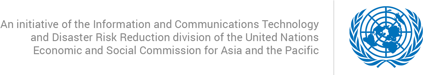
GAR is a biennial global assessment of disaster risk reduction and comprehensive review and analysis of the natural hazards that are affecting humanity.
-
The ETC is a global network of organizations that work together to provide shared communications services in humanitarian emergencies.
-
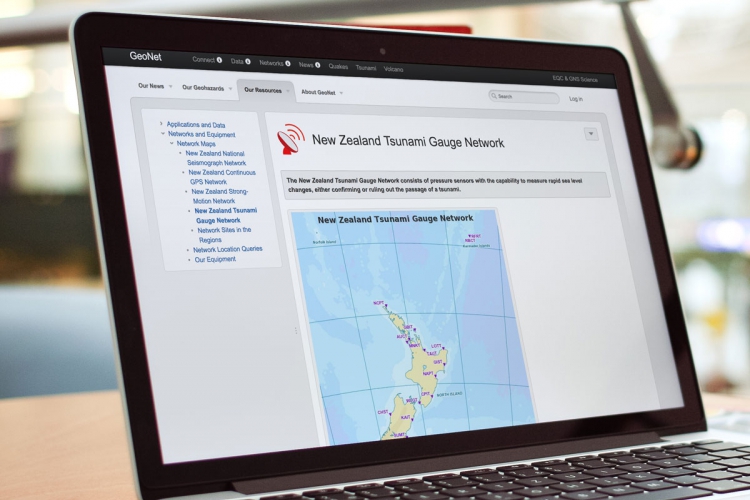
New Zealand uses seismic sensors able to characterise potential tsunami-generating earthquakes occurring off the country's coast.
-
eBayanihan is a mobile and web-based participatory disaster management system that allows citizens to participate in contributing to DRM.
-
Safety Check is a feature of Facebook that is meant to help users quickly alert friends and family that they are safe during times of crisis.
-
Get Ready Get Thru is an online multilingual guide for New Zealand to plan for and respond to disasters.
-
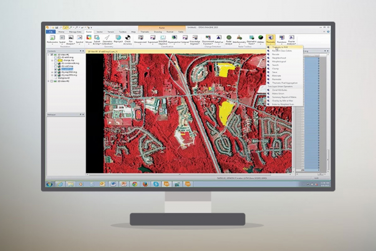
ERDAS IMAGINE is a geospatial data authoring system, including tools for remote sensing, photogrammetry and GIS processing.