Landslides and E-Resilience
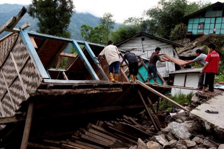
A landslide is the movement of rock, earth, or debris down a sloped section of land. Landslides are caused by rain, earthquakes, volcanic eruptions, or other factors that make the slope unstable. Landslides can have severe consequences for people and critical ICT infrastructure in Asia and the Pacific. The E-Resilience Toolkit offers insights into a spectrum of available ICT tools and best practices that may benefit policymakers, DRM professionals and vulnerable communities in the Asia-Pacific region to enhance e-resilience and disaster risk management in the context of landslide hazard.
Displaying 15 - 21 of 38 tools and best practices relevant to landslide hazard.
-
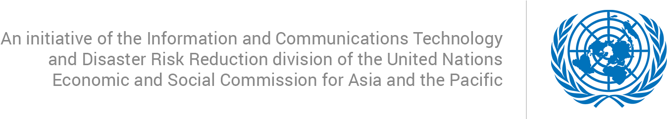
Pakistan Disaster Info is an open source data platform that aims to enable sharing of geospatial datasets and maps on hazards and exposure.
-
GeoDASH is a geospatial data storing and sharing platform for compiling, updating, and sharing geospatial databases.
-
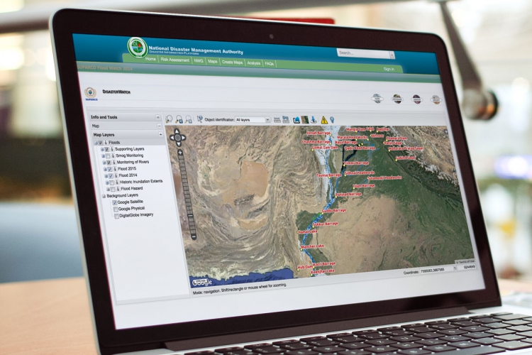
Open Data for Resilience Initiative is designed to reduce vulnerability to natural hazard through data collection and data analysis.
-
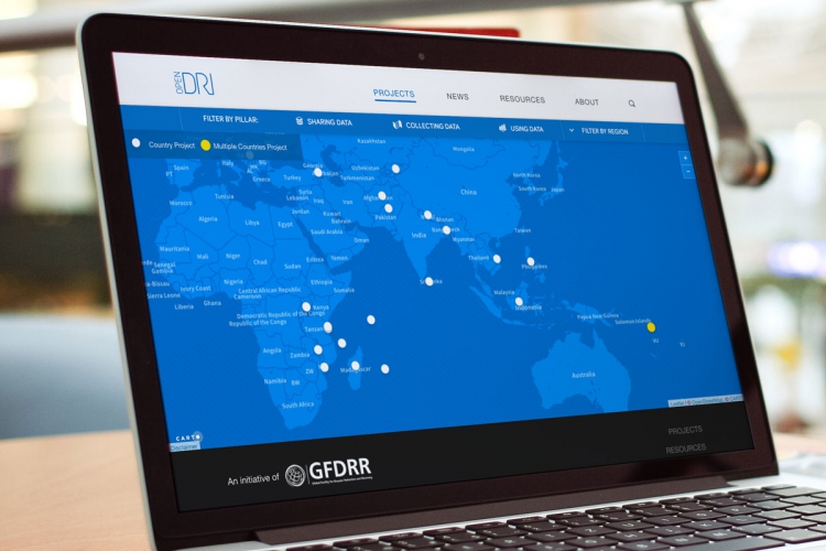
GEOSS is a set of coordinated, independent Earth observation, information and processing systems that interact and offer information to various sectors.
-
Help Kids Cope is a smartphone application designed to assist parents in talking to their children about disasters.
-
GFDRR provides an overview of PDNAs, labeled by country, year and disaster type on its website to assist in recovery and reconstruction planning.
-
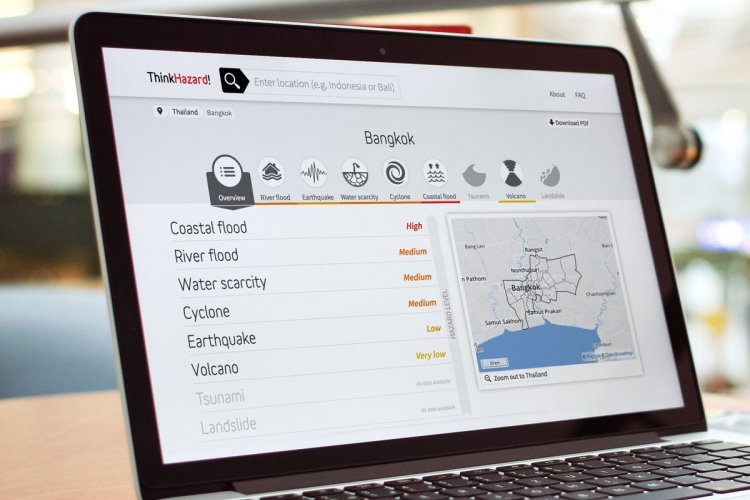
ThinkHazard! is a new web-based tool enabling non-specialists to consider the impacts of disasters on new development projects.